Our Hawkesbury-Nepean River
Our River
Water is essential to human life and the health of environment. The Hawkesbury-Nepean River is the largest and one of the most important river systems in NSW. It acts as a complex, living entity by providing habitats for numerous native plant and animal species, supplying fresh drinking water, and supporting many of Sydney’s critical industries. Water is necessary not only for life to exist, but to also flourish.
Since European settlement, the river has been increasingly relied upon to meet the demands of our growing population. It now provides 97% of the fresh drinking water for more than 4.8 million people living in and around Sydney. It also supports the agriculture and aquaculture industries that provide much of Sydney’s fresh food, as well as supporting other mining, manufacturing, processing, recreation, and tourism industries. In many ways, the river underpins the development of Sydney itself.
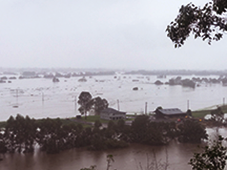
As a result of increasing pressure, the health of the Hawkesbury-Nepean River system has declined over time. Population growth across Sydney has resulted in large volumes of water being taken out of the river for drinking water, irrigation, and industrial uses. Pollution and high nutrient levels from agricultural, urban, and industrial runoff as well as treated sewerage from the number of sewerage treatment plants has contributed to the degrading river system.
As a city and people, we owe much of our achievements to the Hawkesbury-Nepean River system. However, the water that pours downstream for us is but a trickle compared to what the river and its’ ecosystem needs to flourish. By giving back to the river as it has given us, we can ensure that the future of the river, its’ plants and animals, and ourselves will grow and prosper.
Our Catchment
The Hawkesbury-Nepean is a catchment of national significance. The catchment flows through areas of Sydney, supplying the city and surrounding regions with food, water and other resources. The Hawkesbury-Nepean catchment covers more than 22,00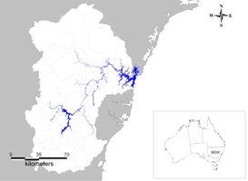 0 square kilometres (2.2 million hectares). The river flows from south of Goulburn to Broken Bay, approximately 470 kilometres in distance, making it the longest coastal catchment in NSW.
The catchment (opens in a new window) includes the coastal reaches from Turimetta Headland to Barrenjoey near its mouth, and catchments for Warragamba, the Upper Nepean and the Mangrove Creek dams, the main water supply reservoirs for the Sydney metropolitan area, including Gosford and Wyong.
The Nepean River
The Nepean River subcatchment lies on the Greater Blue Mountains World Heritage Area through to agricultural and rural-residential properties and there are also significant urban and industrial areas in this subcatchment, including the city of Penrith and Camden, down to the confluence with the Grose River near Yarramundi.
The Hawkesbury River
The Hawkesbury River subcatchment lies on the agricultural and peri-urban fringe of urbanized North Western Sydney. The subcatchment extends from the Nepean River confluence with the Grose River near Yarramundi to the lower estuary of the Hawkesbury River at Webbs Creek near Wiseman’s Ferry. The tidal influence in the Hawkesbury River extends into this subcatchment, reaching approximately 145km upstream from Broken Bay.
What is a catchment?
A catchment is an area of land, usually surrounded by mountains or hills, over which water flows and is collected. When water reaches the lowest point in a catchment, it eventually flows into a creek, river, lake, lagoon, wetland or the ocean.
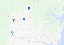
Our Current Focus Areas and Activities along the River
Upper Nepean - Penrith
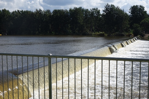
Penrith is located 50 kilometres west of the Sydney CBD, New South Wales, in the local government area of Penrith. Students groups from Western Sydney University carry out annual water quality testing in the Nepean River above and below the weir, as well as in Peachtree Creek and Boundary Creek at Penrith.
Lower Nepean - Yarramundi
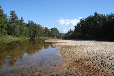
Yarramundi is located 69 kilometres north west of the Sydney CBD, New South Wales, in the local government area of the Hawkesbury. Students and academics from the Western Sydney University have been looking for evidence of platypus populations in the confluence of the Hawkesbury-Nepean Rive, the Grose River at Yarramundi and upstream in the Grose River.
Upper Hawkesbury - Windsor
Windsor is located 55 kilometres north west of the Sydney CBD, New South Wales, in the local government area of the Hawkesbury. The HNWA has begun annual community microplastic counts at Macquarie Park. Students groups from the Western Sydney University also carry out annual water quality testing in the Hawkesbury River and South Creek at Windsor.
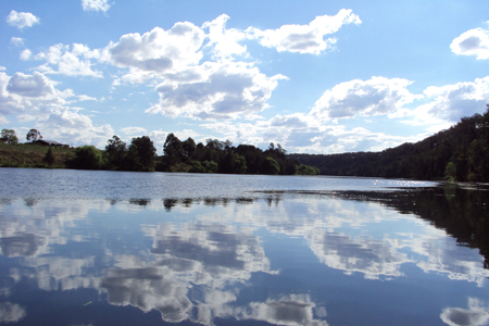
Lower Hawkesbury - Sackville
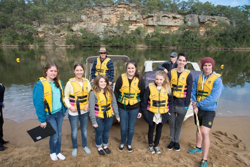
Sackville is located 80 kilometres north west of the Sydney CBD, New South Wales, in the local government area of the Hawkesbury. Students groups from the schools all over Sydney in conjuction with Brewongle Environment Education Centre carry out water quality testing in the Hawkesbury River at Sackville.

Mobile options: